
What do we measure?
3D displacement between two tags.
From video to 3D displacement data.
Our software reconstructs the measurement point in 3D, compares it with previous captures and extracts the displacement data.
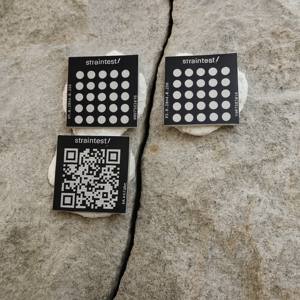
Metal tags made for any structure, any environment.
Attach the tags on both sides of a crack, joint, bearing, or any other element you want to measure.
The tags create a stable reference for accurate measurements with smartphones, cameras, or drones. Their anodized and engraved surface is made to resist UV light, chemicals, pressure washing, and long-term outdoor use.
Read your crack data
Every capture is stored in the platform. View the measurement history, displacement trends, and a 2D or 3D reconstruction of the movement. Your data remains available whenever you need it, even years later.
04 - Crack A4
Min / Max Δ
+0.00 / +3.46 mm
Δ last
−0.57 mm
Avg interval
3 months
Recent measurements
View all 7 →27/01/2026 15:24:07
Measurement #200843930
Distance trend
Evolution of measured distance over time
2D/3D graphs
Detailed movement analysis
For engineers
Smarter monitoring. Less work.
Let anyone collect the data
Clients and inspectors can take measurements with their own phones. Every capture is checked automatically before processing.
Install in minutes
Glue the tags in place and start monitoring. No cables, no power supply and no recalibration between visits.
Use the camera you already have
Capture measurements with a smartphone or drone. No specialist equipment required.
See movement in context
View every measurement point and its displacement directly on the 3D model of the structure.
Aurora Ridge Viaduct
This project monitors a historic mountain viaduct using structural health sensors to track movement trends and support proactive maintenance decisions across seasons and weather conditions.
ARV-01
Arch Crown Left
23 Jun 2026, 08:47
2 minutes ago
ARV-02
Arch Crown Right
23 Jun 2026, 08:47
2 minutes ago
ARV-03
Pier Mid Left
23 Jun 2026, 08:47
2 minutes ago
ARV-04
Pier Mid Right
23 Jun 2026, 08:47
2 minutes ago
View sensors located around the structure
Beyond measurements.
- Team managementProfessionalEnterprise
- Add multiple users, share projects and coordinate measurement campaigns with your team.
- Third-party captureProfessionalEnterprise
- Let clients, inspectors, or on-site teams collect measurements without a full platform account. Each measurement is checked for quality before being added, so you can collect reliable data without going on site.
- Temperature correlationProfessionalEnterprise
- Automatically retrieve temperature data and compare it with movement data to help distinguish thermal effects from structural changes.
- Personalized reportsProfessionalEnterprise
- Generate engineering reports for all your projects with one click. Configure the analysis trends and correlations you want to see and get a deeper analysis, produced automatically from your structure's data.
- Full white-labelingEnterprise
- Create reports and client-facing outputs with your own branding.
- Dedicated support and procurementEnterprise
- Receive dedicated support for onboarding, deployment, procurement and integration into your organization's workflow.
- Drone measurementsEnterprise
- Capture measurements at difficult-to-access monitoring points using drone footage.